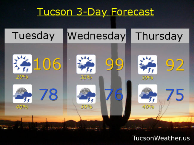
I had a weird dream that my cell phone woke me up with an EXCESSIVE HEAT WARNING warning at 3:00 a.m. Then I woke up and saw that it wasn’t a nightmare, it was true! Be warned. There will be excessive heat. Yesterday we tied the record high of 109. A couple of stray storms made it’s way across town last night, hopefully near you! The airport picked up .05″ which beats a swift kick (don’t ask me how I know that). Moisture is increasing across the area, so today’s expected high of 106 will be a bit uncomfortable. The good news is storms should fire earlier today and by this evening more of us will have a chance of getting wet. Tonight’s low in the upper 70s.
High pressure moving northward with an inverted trough riding our way from the east. Lots of moisture including a couple of hurricanes south of Baja California that will help push more our way. It all adds up to what should be an active week for Monsoon 2018! Early indications are that prime time will be tomorrow night and storm chances remain good into the weekend!
Partly sunny tomorrow with a 30% chance for storms and a high near 99ish. Mostly cloudy tomorrow night with a 50% chance for storms mid 70s. 30%/40% Thursday low 90s. 20%/40% Friday mid 90s. 30%/40% Saturday mid 90s, 20%/30% Sunday mid 90s. 20% Monday mid 90s.