It’s freezing out there! Well. For most locations. Lows so far this morning range from the upper 20s to the mid 30s with a crisp 32 degrees at the airport as I scribble this out on my PC. A FREEZE WARNING remains until 9:00 a.m., so hopefully the teenagers were let back in the house last night. The big weather stories are; the wind for the next couple of days, a warm weekend, and a pattern change that should open the door to rain and mountain snow just in time for Christmas! Hold on to your chapeau, here we go!
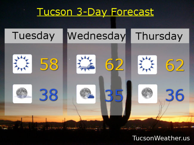
Sunny, breezy (OK, windy, depending on where you are), and cool today with east winds 15-25 mph gusting to around 35 and a high in the upper 50s.
Breezier tonight with winds gusting to near 40 (for some) and a low in the upper 30s.
Partly sunny and breezy fo’ sheezy tomorrow. East winds gusting to near 40 and a high in the low 60s. Winds relax Thursday with sunshine and a high in the low 60s. Sunny and warmer as we head into the weekend. Upper 60s Friday. Mostly sunny mid 70s Saturday! Partly sunny mid 70s Sunday! A slight chance for showers Monday as our weather pattern starts to change. Monday’s high in the low 70s. Stay tuned!