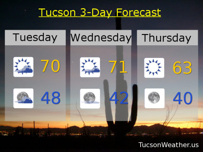
Rain chances are back out of the forecast. I’m still holding out a little hope that we may manage some showers since one of the computer models is hanging on to the possibility. The expectation was never more than a tenth of an inch anyway, but still. Even a few drops would be encouraging! A low over southern California is making its way to central Arizona today bringing clouds and a chance of rain for our local mountains by tonight and valley locations mainly to our east. Snow levels 7,000 – 8,000 feet by tomorrow morning, so mountains to the east could see a couple inches of snow above that, but nothing too serious. Once the storm weakens and moves east we will see clearing skies and colder air settling in. Low 60s for the high Thursday! Warming up as we head into the weekend with highs in the upper 60s Friday. Mid 70s Saturday and Sunday. Low 70s Monday. Lows as low as around 40ish Friday and Saturday morning.