A HARD FREEZE WARNING in effect tonight from 11:00 p.m. until 8:00 a.m. tomorrow morning. Please. For the sake of all that is right and good let the teenagers sleep inside tonight! Also. Tonight’s record low is 25 set in 1955. Do we dare get that cold? The forecast is close at 27. We’ll see. We are between storms today and tomorrow. A lot of sunshine, but not very warm. Especially when you consider the average high for this time of year is 69. We’ll be at least 15 degrees colder than that through Saturday!
The next storm looks cold and very wet. A foot or three of snow for the mountains possible Thursday through Friday night! A WINTER STORM WATCH is in effect for Summerhaven from Thursday morning at 11:00 until Friday evening at 5:00. Three-quarters to an inch and a half of rain perhaps for us lowlanders. Also. Maybe (maybe) some snow mixed in in the Metro Friday night/Saturday morning. That didn’t really pan out last night, so we’ll see.
The Sun returns this weekend with a high on Sunday near 60ish! Still below average, but some rays of hope. (see what I did there?)
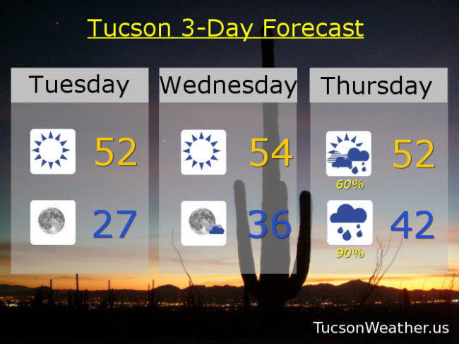
Sunny and cool today with a high in the low 50s. Clear and cold tonight with a low in the upper 20s. Sunny mid 50s tomorrow. Showers and breezy Thursday low 50s. Rain, heavy at times, Thursday night and Friday. Friday’s high in the upper 40s. A chance for rain and snow showers Friday night with a low in the upper 20s. Sunny Saturday low 50s. Sunny Sunday 60ish. Mid 60s Monday.