I bet your high school yearbook says you were likely to be slightly cooler than average. 😎 Certainly we are living in such a time. You know. Until Thursday. Then it’s time for the above average to much above average folks to shine! Early next week is for those of you who were voted, “most likely to crash snow levels” as a cold storm system heads our way. OK weather nerds, let’s take a closer look at the forecast!
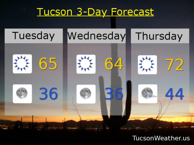
Sunny and breezy fo’ sheezy today and tomorrow. North winds 10-20 mph this afternoon and east winds 15-20 gusting to 30 tomorrow. Highs in the mid 60s with lows in the mid 30s.
Our old pal high pressure builds in for a terrific warm up into the weekend. A few high clouds from time to time for possible sunrise and sunset enhancement. Mostly sunny Thursday low 70s. Partly sunny Friday upper 70s. Upper 70s to near 80ish Saturday. Mostly sunny mid 70s Sunday. A chance for showers Monday low 60s. Enjoy!