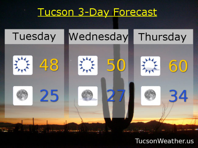
Due to lack of interest, this morning’s HARD FREEZE WARNING has been cancelled. Actually it’s the cloud cover. As the “heat” tries to escape into the space (echo: space space space) the clouds act as a blanket to keep the “heat” in. So. We are near 40ish to start today. We’ll keep it on the cool side with a high this afternoon only in the upper 40s.
A HARD FREEZE WARNING remains in effect for tonight/tomorrow morning. Please for the love of all that is right and good, let the teenagers sleep inside tonight. Low near 25 to start tomorrow. Wednesday’s high near 50ish. 60ish Thursday. Upper 60s Friday. Mid 70s Saturday and Sunday! A slight chance for rain and breezy Monday low 70s. Enjoy!