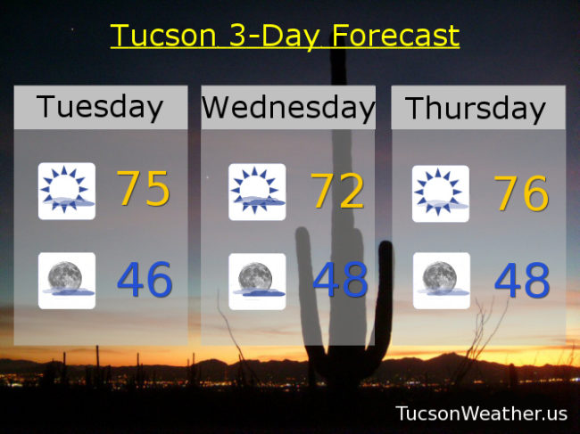
Another shot of Arctic air is moving into the eastern half of the country reinforcing the frigid temperatures that have been hanging out there for the past week +. Even northern Florida could see some snow today and tomorrow! That leaves the SW US (us) as the nations last best hope for mild temperatures and fun in the Sun! (OK, filtered Sun). The computer models can’t agree on the details, so some of this forecast is up in the air. (see what I did there?) A mix of high clouds and sunshine today and continued warm with highs in the mid 70s. A cold front approacheth from the east tomorrow but how far west will it get? If it moves through Tucson our forecast high of 72ish will be optimistic. Either way we should see some gusty east winds in gusty east winds prone areas such as much of Tucson, but not as bad in Oro Valley, for example. Thicker high clouds tomorrow too. Then it’s mostly sunshine Thursday and Friday with highs in the mid 70s. This weekend is a bit of a mystery as well. Increasing clouds Saturday as a storm approacheth, but the betting money is keeping the rain chances north of us this weekend. Even then, only light rain is expected. (half the calories of our regular rain). Mid 70s Saturday. Low 70s Sunday with partly sunny skies this weekend. Mostly sunny Monday near 70. We’ll keep an eye on all of it as usual. Stay tuned!