Well that escalated quickly… or will. Rain in the forecast and the pattern change that is coming should open the door for a few storms to move through. Considerable high cloudiness at times through tomorrow with some breaks in the clouds as well. Could lead to some great sunrise and sunset enhancement! Or. The clouds will be too thick and we’ll get skunked like yesterday evening. Keep those 35mm cameras handy and get ready to run down to the One Hour Photo Moto! A small but vigorous upper level low near the central California coast will move south and displace our high pressure to the west. The low is then expected to weaken some and move across the area. Rain showers for us bottom dwellers and snow above 7,500 feet in the forecast Thursday night into Friday. Only a tenth of an inch of rain or less expected in the Metro and an inch or three of snow in Summerhaven. Another storm on the heels of the first should be in here just in time for the weekend. Much more moisture to work with. We could see up to three-quarters of an inch of rain, but we are a ways out, so don’t quote me on that just yet. Rain ending Sunday with yet another system following in behind. The third one looks to be colder, so lower mountain snows early next week. You know, assuming this all comes true. Stay tuned!
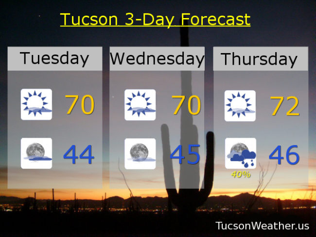
Partly sunny today and tomorrow with highs near 70ish. Mostly cloudy tonight and partly cloudy tomorrow night with lows in the mid 40s. Mostly sunny Thursday low 70s. Scattered showers Thursday night mid 40s. Isolated showers Friday morning becoming mostly sunny upper 60s. 20% Saturday upper 60s. 40% Saturday night mid 40s. 20% Sunday mid 60s. 10% Monday low 60s. Enjoy!