Here we go! A strong storm system is dropping flooding rains on parts of the California coast this morning. The low will head toward northern Arizona as we go through the day and move across tonight. Winds will be picking up as the storm approacheth today and moves through tonight. The computer models have backed off just a tad on rainfall amounts with the storm, but we still could see up to a half inch of rain in spots. Snow levels will start quite high but crash to near 5,000 feet by tomorrow morning. Still expecting 4-7 inches of snow above 7,000 feet with higher amounts possible above 8,000. The storm moves on to northern New Mexico by late Wednesday and we’ll be left with cooler temperatures for a day or two before we start to warm back up. Enjoy!
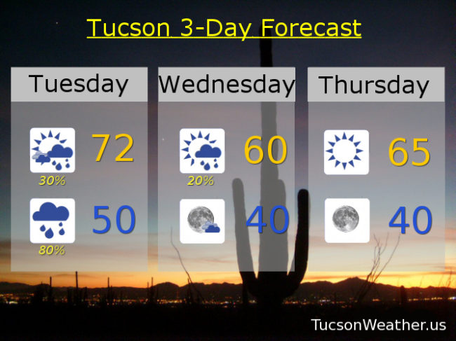
Partly sunny today with scattered showers possible by late afternoon and a high near 72.
Breezy tonight with south winds 10-20 mph gusting over 30 becoming WSW after midnight as the front moves through. Showers and possibly a thunderstorm (hopefully near you) before 2 a.m. then scattered showers. Low near 50.
Partly sunny tomorrow with isolated showers then clearing late in the afternoon and a high near 60.
Sunny Thursday 65ish. Mid 70s Friday, Saturday, Sunday and MLK Day.