Interesting day yesterday. Most not getting the advertised rain with some notable exceptions. An early afternoon storm dumped some nice rain on the Tortolita Mountains which moved to the east and got parts of Marana. Then three separate showers with some thunder formed over southern Oro Valley. Downtown Tucson had a quick downpour later in the afternoon. Then there was the airport. 1.01″ inches of rain fell! A new record for the date. Most of it came down in about a half hour!
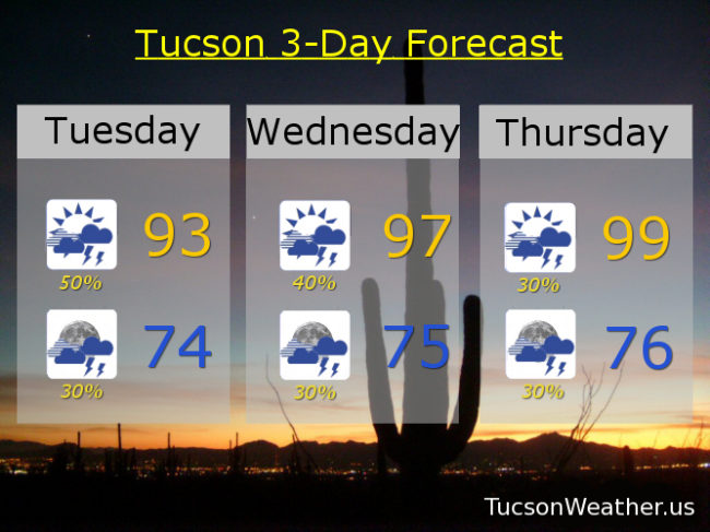
If you missed out on yesterday’s showers I give you hope. Light rain (half the calories of our regular rain) moving through the Metro this morning should end in an hour or two. Then mostly cloudy skies most of today. If we get some clearing that will certainly help the cause for afternoon and evening storm chances. Still. The inverted trough we’ve been talking about is now to our west, but still close enough to add some instability to the atmosphere. The National Weather Service has our afternoon storm chances at 50%. Lots of moisture in place so some of the storms may produce locally heavy rainfall. Hopefully near you! Today’s high only in the low 90s.
Scattered showers and storms possible tonight, perhaps a few overnight, with a low in the mid 70s.
40% chance for storms tomorrow afternoon/evening with a high in the upper 90s. 30% chance for storms Thursday upper 90s. 20% chance Friday upper 90s. 40% chance Saturday mid 90s. 30% Sunday mid 90s. 30% Monday upper 90s. Viva Monsoon 2018!