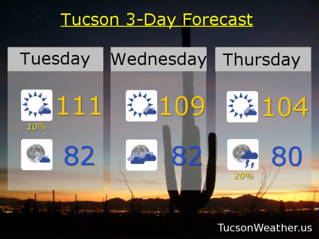
EXCESSIVE HEAT WARNING continues until tomorrow night at 8:00, so be warned, the heat will be excessive. A couple storms popping up this morning near Catalina to near Oracle. Nice light show from the deck from about 3:30 until after 4:00. Another isolated storm right now (6:10 a.m.) over the Rincons. We’ll keep isolated storms in the forecast today, but the weather headline is the head. High pressure over SE Arizona basically trying to kill us. Today’s forecast high of 111 will break the daily record of 109 and is just 3 degrees shy of the all-time record high for July. Let’s hope it doesn’t come to that! Tonight any stray storms that form will dissolve leaving partly cloudy skies and a not so low low in the low 80s.
109 tomorrow will tie the record high if it comes exactly true.
High pressure moving to the NW will open the door for a return of deeper moisture. That means a better chance for storms starting Thursday evening and increasing this weekend. Thursday’s high 104ish. 20% chance for storms Friday 101. 30% Saturday 98. 20% Sunday upper 90s. 30% Monday upper 90s. Be cool!