RAIN! At least a little bit for most. Some a bit more than that. Nice and cool today with an increasing chance of showers as an upper low slowly moves our way from the Gulf of California. The mountains are getting a bit more snow than expected above 7,000 and some valley locations could pick up a half inch of rain today. Hopefully near you! Some of the stronger storms this afternoon could even have small hail. Today’s high is only expected in the upper 60s. The National Weather Service says that the last time a May day didn’t get out of the 60s was 2009. A rare cool May day indeed! The storm heads into New Mexico by tomorrow with a slight chance of a shower or storm on the backside. Then a warming trend the rest of the week. Another storm misses us to the north Sunday and Monday for breezy conditions and a bit of a cool off. Something for everyone! Enjoy!
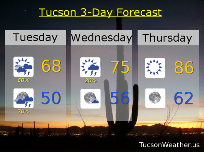
Mostly cloudy today with scattered showers and storms, especially this afternoon and evening, with a high in the upper 60s.
Mostly cloudy tonight with a good chance for showers early and then decreasing overnight with a low near 50.
A chance for a lingering shower or storm tomorrow otherwise mostly sunny with a high in the mid 70s.
Sunny mid 80s Thursday. Mid 90s Friday. Upper 90s Saturday. Breezy low 90s Sunday. Breezy upper 80s Monday.