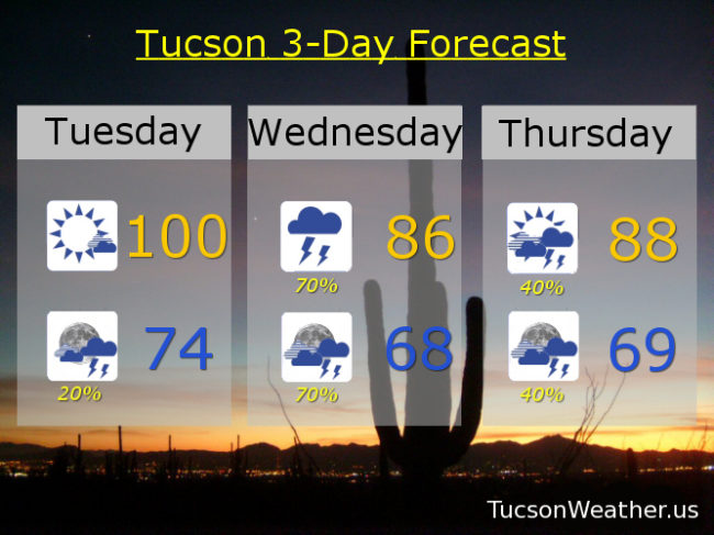
104 yesterday was just 1 from the record of 105. Missed it by that much. Yikes! One more 100 degree day today before a dramatic reversal of fortunes. Moisture already on the increase with high pressure to our east and a trough to our west. That has Arizona smack dab in the middle of a southerly flow. Deep moisture headed our way with a chance for storms today mainly to our south and east possible moving into the Metro this evening. Today’s high near 100ish and tonight’s low in the mid 70s.
Tomorrow looks like prime time for showers and storms with heavy rain possible. Near record levels of moisture in here along with an inverted trough moving northward from Baja California. The result should be widespread heavy rainfall across the area with some areas getting two inches of rain or more! The National Weather Service is likely going to issue a Flash Flood Watch, so we’ll probably test the Flash Flood Watch jinx! Hopefully everything will come to pass as forecast. With the clouds and rain around, tomorrow’s high only in the mid 80s!
Moisture hangs around Thursday with a 40% chance for scattered storms and a high in the upper 80s. Some drying Friday, but still a 30% chance for storms and a high in the low 90s. 10% Chance Saturday mid 90s. Sunny Sunday and Monday upper 90s. Viva Monsoon 2018!