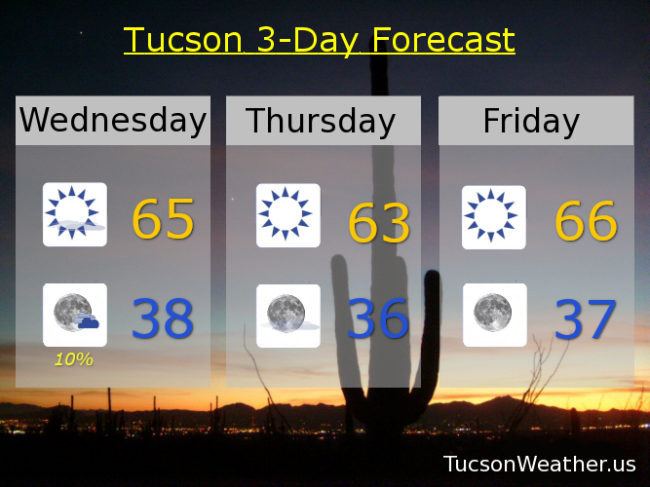
It’ll be hard to tell, but a weak and dry storm will be moving through tonight. Perhaps a bit breezy this afternoon, but a lot of sunshine today and cool like yesterday. High in the mid 60s. A slight chance for light rain tonight and maybe an inch or two of snow above 7,000 feet (I’m looking at you Summerhaven), but clearing out by morning and chilly (mmm Chili’s) with a low in the upper 30s.
Cooler behind the storm tomorrow with sunshine low 60s. (it’s tough being the cool kids) Warming up for the weekend! Mid 60s Friday. Low 70s Saturday. Mid 70s Sunday.
A storm appraocheth for next week! We can make it colder, stronger, and wetter. (the Steve Austin storm? let’s go with it!) We’ll have to keep an eye on this one as snow levels will be quite low with a decent shot for cold rain and low mountain snow. We’ll know more as it gets closer. (and even more after it’s done!) Right now let’s call it mostly sunny and breezy Monday with a 20% chance for showers and a high in the low 60s. A slight chance for rain and snow showers Tuesday (you read that right. that is a quote from the official NWS forecast) with a high in the mid 50s. Stay Tuned!!!