Winter is returning to us as a series of storms are fixin’ to head our way. Storm numero uno is approaching the central California coast and then will proceed to approacheth Arizona. As it moves through Thursday night into Friday we’ll see showers developing and snow above 7,500 – 8,000 feet. Not much snow accumulation in Summerhaven from this first storm, but the ski area could see an inch or three. Here in the lowlands we are expecting a few hundreths up to a quarter of an inch with prime time for rain being late tomorrow night into Friday morning. Storm numero dos will be right on it’s heels. This one is a bit colder and stronger. Three to eight inches of snow perhaps for Summerhaven this weekend and up to a half inch of rain in the Metro. Storm numero tres? ETA is Monday night into Wednesday. Still a lot of question marks with the main question being how much moisture will it bring. It will be the coldest of the three. We’ll just have to stay tuned!
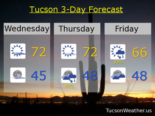
Partly sunny today with a high in the low 70s. Partly cloudy tonight mid 40s. Mostly sunny tomorrow low 70s. 30% late tomorrow night into Friday. Friday’s high 66ish. 20% Saturday upper 60s. 40% Saturday night mid 40s. 30% Sunday mid 60s. 10% Monday low 60s. 20% Monday night low 40s. 20% Tuesday low 60s. Enjoy!