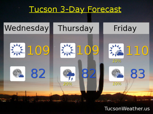
Ugh! So tedious. The EXCESSIVE HEAT WARNING is baaaack. In effect starting tomorrow at Noon until 7:00 p.m. Friday. Be warned, the heat will be excessive. Make sure you stay hydrated lest you burst into flames. Today will be hot too with a high of 109 expected. We get to start some new streaks. Today will be our second day in a row over 105. This morning’s low made it the second in a row with a low over 80. Highs over 105 expected until Saturday. Lows over 80 expected through Tuesday and possibly beyond. The good news is even though the high pressure is expanding and flexing its muscles, it’s also moving toward the Four Corners which will give us an influx of moisture and at least a shot at some isolated to scattered storms. Monsoon 2017, Monsoon 2017, wherefore art thou?!
Mostly sunny today with a high near 109.
Partly cloudy tonight with a low in the low 80s.
Mostly sunny tomorrow with a high near 109 and a chance for isolated showers in the evening with a low in the low 80s.
Isolated storms maybe Friday, 110ish. 20% chance of storms Saturday through Tuesday with highs near 105, 103, 103, 103 respectively.