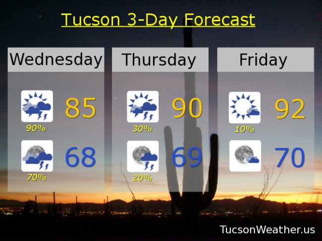
A record amount of moisture for a September 19th in place. Add some energy as a trough approacheth from the west and you have a recipe for numerous showers and storms with locally heavy rainfall. So. The National Weather Service has issued a FLASH FLOOD WATCH starting at 11:00 this morning in effect until 11:00 tonight. The forecast calls for .75″ – 2.50″ of rain! Hopefully that comes true (hopefully near you) and Monsoon 2018 will leave us with lasting memories. With the clouds and expected rain today’s forecast high is only 85. Showers and storms may last into the overnight hours with a low tonight in the upper 60s. Viva Monsoon 2018!
We get back to a westerly flow starting tomorrow and we start a drying trend. Scattered storms still hanging in there for tomorrow with a high near 90ish. Just a 10% chance Friday low 90s. Sunny mid 90s Saturday through Tuesday.