
Forecast for Monday, February 5, 2018
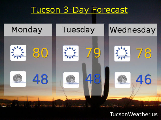
More of the same as we go through the week. A few high clouds for possible sunrise and sunset enhancement, but mostly it’s sunshine and warm. Highs in the upper 70s to near 80 and lows in the mid to upper 40s. A change in the weather pattern will bring a strong low pressure system our way by the end of the weekend into early next week, but right now it looks dry with a pick up in winds and lower temperatures. Of course we’ll keep you posted!
Sunny today with a high near 80.
Clear skies tonight with a low in the upper 40s.
Sunny tomorrow with a high in the upper 70s. Upper 70s Wednesday. Near 80 Thursday and Friday. Upper 80s Saturday. Mid 70s Sunday.
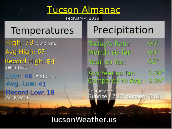
Almanac for Sunday, February 4, 2018
Forecast for Sunday, February 4, 2018
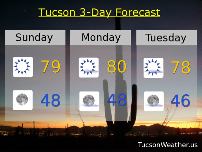
High pressure over the west keeping us warm and dry. A storm skirting the Four Corners on Tuesday will pick up the breezes a bit and cool us off a degree or two. Otherwise lots of sunshine and highs in the upper 70s to near 80. A few high clouds from time to time for possible sunrise and sunset enhancement. A hint in the computer models that a major weather pattern change may (finally) usher in a decent Winter storm after next weekend. Still a ways out. We’ll burn that bridge when we get to it. Stay tuned!
Sunny today with a high in the upper 70s.
Clear skies tonight upper 40s.
Mostly sunny tomorrow near 80. Breezy Tuesday upper 70s. Mostly sunny Wednesday upper 70s. Mostly sunny low 80s Thursday. Upper 70s Friday and Saturday.
Almanac for Saturday, February 3, 2018

Forecast for Saturday, February 3, 2018
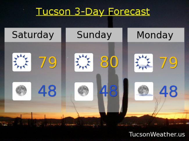
Nothing new to report. High pressure ruling the roost with sunshine and highs in the upper 70s to near 80 and lows in upper 40s. Six more weeks of Winter!
Almanac for Friday, February 2, 2018

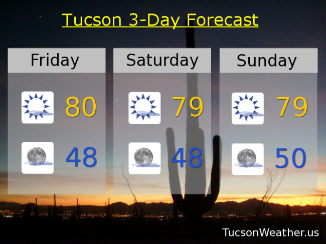
Forecast for Friday, February 2, 2018
It’s Friiidaaay!!!
Our persistent weather pattern persists. Some high cloudiness for possible sunrise and sunset enhancement and highs in the upper 70s to near 80. Lows in upper 40s to near 50. Enjoy!
Mostly sunny today near 80.
Mostly clear tonight upper 40s.
Mostly sunny tomorrow and Sunday upper 70s. Near 80 Monday. Upper 70s Tuesday and Wednesday. Near 80 Thursday.
Almanac for Thursday, February 1, 2108

January 2018 – Warmest on Record
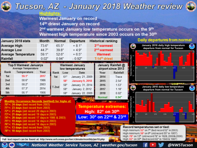
From the National Weather Service. All the details are here: https://www.wrh.noaa.gov/twc/climate/monthly/jan18.php