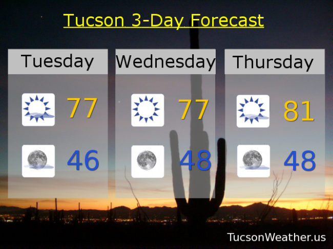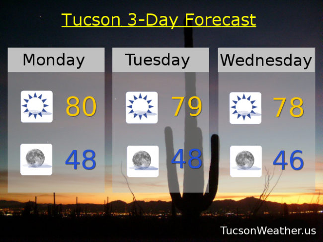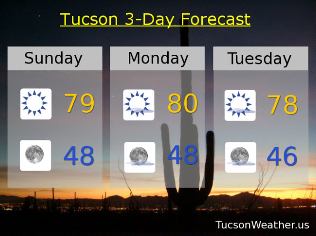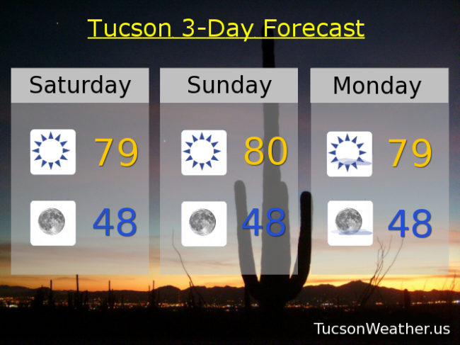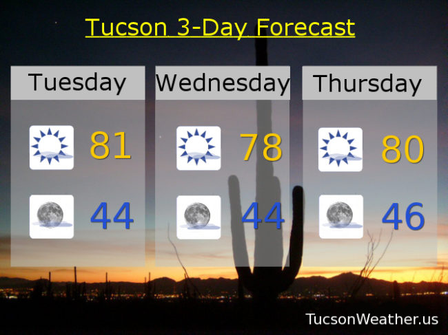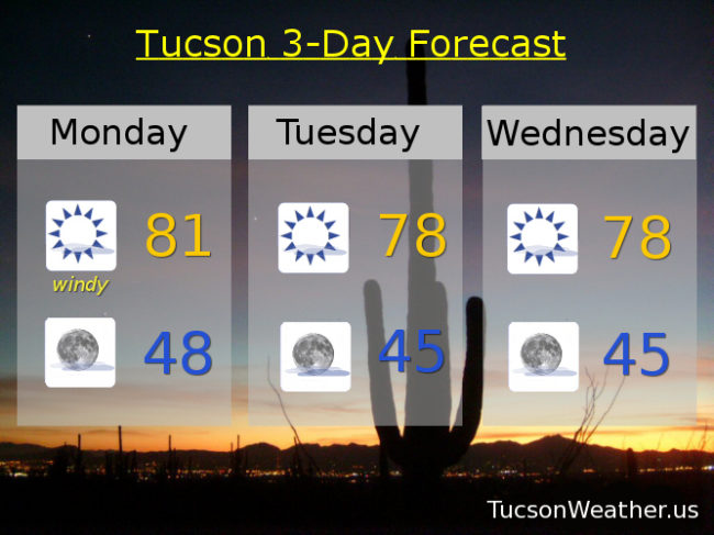
Nary a cloud in the sky and high temperatures running 9-13 degrees above average for early February. Some relief in sight, but it looks like it will stay dry. A weak system moves through on Sunday for a few degrees of cooling. A stronger storm Tuesday gives us a slight chance for showers and it’ll be cooler, but still a degree or two above average for this time of year. It’s still a ways off so stay tuned!
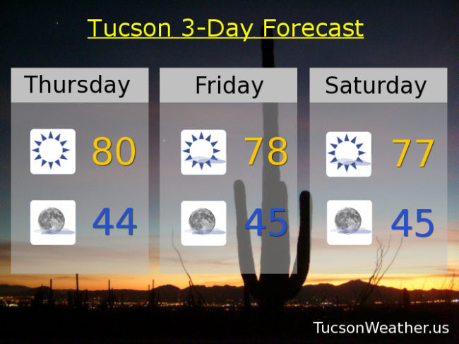
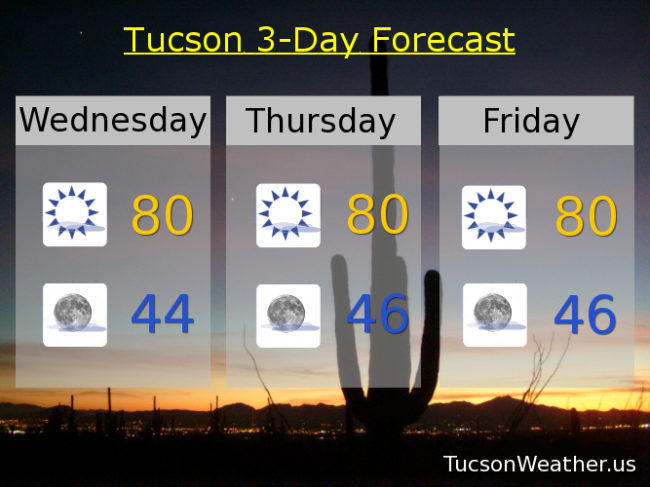
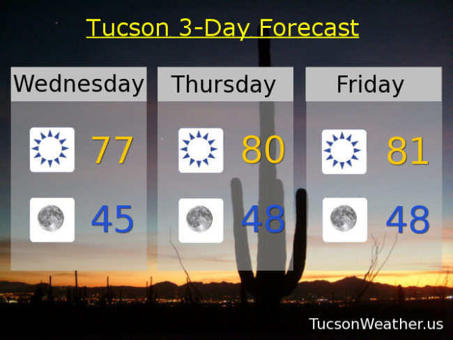
Sunny today with a high in the upper 70s.
Clear skies tonight with a low in the mid 40s.
Sunny near 80 tomorrow. Low 80s Friday. Upper 70s Saturday. Mid 70s Sunday. Low 70 Monday. Slight chance for showers Tuesday near 70.